

Canadian Roadtrip Project.
I Went on a road trip across Canada. Started on the East Coast, and drove to the west, everything kept changing—forests, cities, mountains, and endless highways.We stopped in small towns, tried local food, and met different people along the way. Finally, we made it to the West Coast. The ocean was different there. Driving across Canada showed me how big and beautiful the country really is.
My favourite 5 Communities
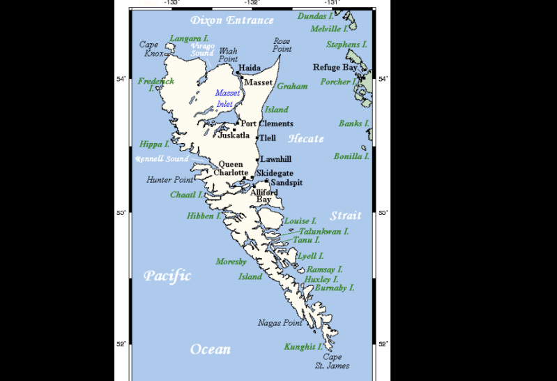
Graham Island

Resources
Graham Island, the largest island in Haida Gwaii off the coast of British Columbia, has an economy and way of life that are deeply connected to its rich natural environment. Fishing has long been one of the most important resources, with the surrounding Pacific waters providing abundant species such as salmon, halibut, and shellfish, which support both commercial fisheries and local food systems. Forestry is another key industry, as the island’s dense temperate rainforests—made up of cedar, spruce, and hemlock—have historically supplied timber for logging, although modern practices increasingly focus on sustainability and conservation to protect the delicate ecosystem. Tourism has become a rapidly growing sector, drawing visitors from around the world who are interested in the island’s rugged landscapes, ancient forests, and diverse wildlife, including eagles, bears, and marine life. In addition, Graham Island holds immense cultural significance for the Haida Nation, and cultural tourism plays an important role, with visitors coming to learn about Haida art, traditions, and history through guided experiences, museums, and heritage sites. Together, these resources—fishing, forestry, and tourism—form a balanced yet evolving economy that reflects both the natural wealth of the island and the ongoing efforts to preserve its environment and cultural identity.

Geography
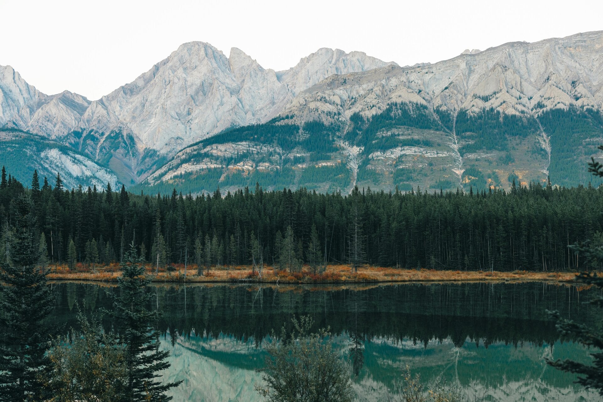
Graham Island is located off the northwest coast of British Columbia and is part of the Western Cordillera landform region. This means the land is very natural and rugged, with mountains, rocky coastlines, dense forests, and lots of rivers and streams spread throughout the island. Because it is on the west coast, it gets a lot of rainfall, which helps create thick, green forests filled with tall trees like cedar, spruce, and hemlock. The landscape is also shaped by both land and ocean, so there are dramatic shorelines, beaches, and cliffs where the forest meets the Pacific Ocean. The mountains aren’t extremely high, but they are still noticeable and add to the uneven, wild terrain of the island. Overall, Graham Island has a really unique geography because it combines coastal features with forested land, making it feel remote, natural, and full of biodiversity.

Soil&Rocks
The rocks on Graham Island are mainly igneous and sedimentary, which means they formed a long time ago from cooled lava and from layers of sand, mud, and other materials that slowly built up and hardened over time. Because of this, the island has a pretty varied and uneven landscape, with lots of rocky areas, especially near the coast and in higher ground. The soil that formed from these rocks is often thin, acidic, and not very rich in nutrients, which makes it difficult for farming or growing crops on a large scale.
Even though the soil isn’t great for agriculture, it is still really important because it supports the huge temperate rainforests that cover most of the island. These forests include tall trees like western red cedar, Sitka spruce, and hemlock, which thrive in the damp climate and can grow even in less fertile soil. The forest ecosystem is really important because it helps protect wildlife habitats, prevents erosion, and keeps the environment healthy and balanced.
The rocky soil and bedrock also play a big role in shaping the island’s landscape over time. Rain and rivers slowly break down the rock, creating valleys, streams, and coastal features that give Graham Island its unique natural look. So, even though the soil isn’t very good for farming, it still supports one of the island’s most important features—its dense forests—and helps shape the island’s environment and economy overall.
Water
Graham Island is surrounded by the Pacific Ocean, which plays a huge role in both the environment and the way people live there. The ocean is important for transportation, since boats and ferries are used to connect the island to other parts of British Columbia. It is also a major resource for fishing, with waters full of salmon, halibut, crab, and other seafood that support both the local economy and traditional food systems.
On the island itself, there are also many rivers and streams that flow through the forests and eventually reach the ocean. These freshwater sources are really important because they provide drinking water, support plant growth, and create habitats for fish and other wildlife. The mix of freshwater and saltwater environments helps make the ecosystem very rich and diverse.
Because Graham Island gets a lot of rainfall, the rivers and streams are usually full and active year-round. They also help shape the land over time by slowly carving through soil and rock, creating valleys and natural drainage systems. Overall, water is a key part of Graham Island’s geography because it connects the land, supports wildlife, and plays a big role in both the environment and human activity.
Climate
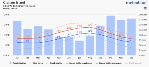
Graham Island has a maritime climate, which means it is strongly influenced by the nearby Pacific Ocean. Because of this, the temperatures stay fairly mild throughout the year compared to many other parts of Canada. Winters are usually cool and wet rather than extremely cold, and summers are mild and not overly hot. This happens because the ocean warms up and cools down more slowly than land, which helps keep the island’s temperatures more stable.
One of the biggest features of the climate is the high amount of rainfall. Graham Island receives a lot of precipitation, especially during the fall and winter months, when storms move in from the Pacific Ocean. This constant moisture is what allows the island to support dense temperate rainforests. The forests stay green all year because there is always enough water for trees like cedar, spruce, and hemlock to grow.
Fog is also common, especially near the coast, because of the mix of cool ocean air and moist land air. Winds can be strong at times when Pacific storms pass through, but overall the climate is more damp and mild than extreme. All of these factors together create a very lush environment, where plant and animal life can thrive because there is so much moisture and relatively stable temperatures year-round.

Population and ethnicity
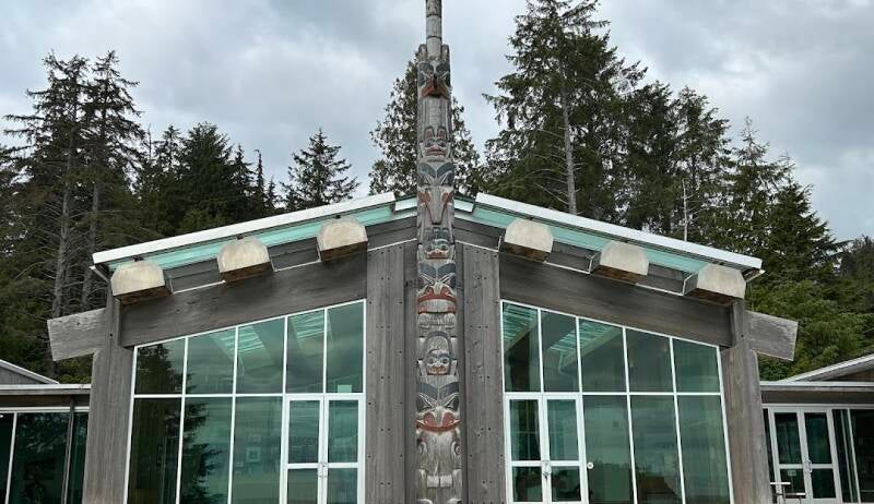
The population of Graham Island includes many Indigenous people, especially the Haida Nation, who have lived in the region for thousands of years. The Haida culture is still very important today and is a major part of life on the island. Their traditions, language, and art are deeply connected to the land and ocean, which have always provided food, materials, and spiritual meaning.
Even though there are also non-Indigenous residents on the island, the Haida Nation plays a big role in the community and in protecting the environment. Many place names, stories, and cultural sites come from Haida history, showing how strong their connection to the land is. Art is also a big part of their culture, especially things like carvings, totem poles, and weaving, which are still created and shared today.
Overall, the population of Graham Island is shaped a lot by Haida heritage, and their presence continues to influence the culture, identity, and stewardship of the region.
Brief History
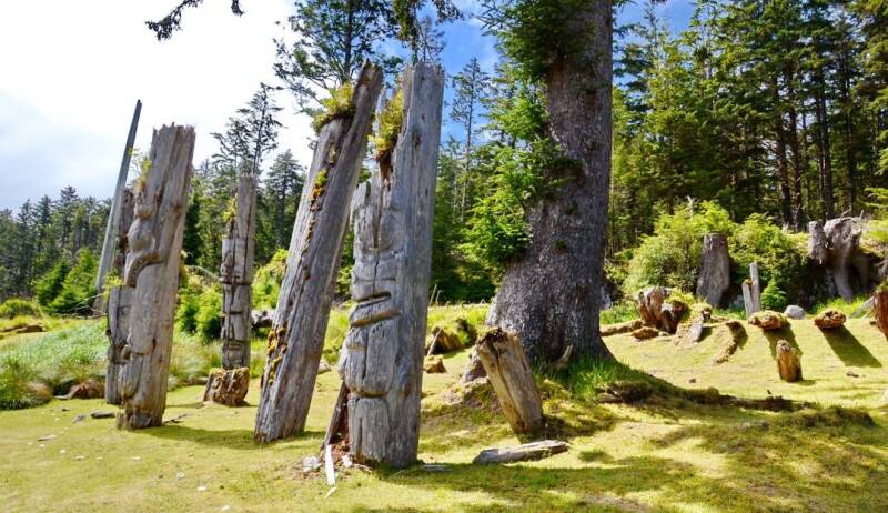
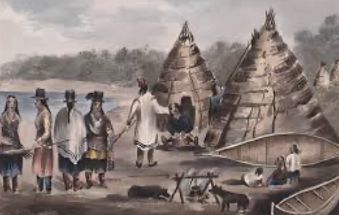
Graham Island has been home to the Haida Nation for thousands of years, long before European contact. The Haida built strong and well-organized communities based on fishing, hunting, and trade, using the ocean and surrounding forests as their main sources of food and materials. They were skilled ocean travellers and used large cedar canoes to travel between islands and along the coast for trade and seasonal activities. Over time, they developed a rich and highly respected culture, especially known for their art, such as totem poles, carvings, woven hats, and ceremonial masks, which often tell stories about their history, clans, and connection to nature.
In the late 1700s, European explorers and traders arrived on the west coast of British Columbia, mainly interested in fur trading and later in timber resources. This contact brought major changes to the region. Unfortunately, it also led to a large population decline for the Haida due to diseases brought from Europe, which had a huge impact on their communities and way of life. As settlement increased, industries like logging and fishing became more developed, and the economy of the island began to change to focus more on resource extraction.
Despite these challenges, the Haida Nation has continued to survive and adapt over time. Today, they play a very important role in protecting both their culture and the natural environment of Graham Island. There has been a strong effort to preserve the Haida language, traditions, and art, while also managing the land and waters sustainably. Because of this, Graham Island is now known not only for its natural beauty and resources, but also for its deep history and the lasting presence of the Haida people.
Spots
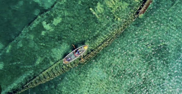
A popular place to visit is Haida Gwaii, which is known for its incredible natural landscapes, wildlife, and cultural heritage sites. It is made up of islands off the northwest coast of British Columbia, including Graham Island, and is often called one of the most unique and remote places in Canada.
Visitors are drawn to Haida Gwaii because of its stunning scenery, which includes dense rainforests, rocky coastlines, long sandy beaches, and dramatic ocean views. The environment feels very untouched and peaceful, making it a great place for people who enjoy nature and outdoor exploration. Wildlife is also a big attraction, with animals like black bears, bald eagles, whales, sea lions, and many types of fish found in the surrounding waters and forests.
Another important reason people visit is its strong cultural heritage. Haida Gwaii is the traditional territory of the Haida Nation, and there are many cultural sites, villages, and art pieces that show their deep history and traditions. Places like old village sites, totem poles, and museums help visitors learn about Haida stories, art, and way of life, which have existed for thousands of years.
Overall, Haida Gwaii is a popular destination because it combines natural beauty with rich Indigenous culture, making it both a scenic and meaningful place to explore.
Why live there?
People live on Graham Island because of its peaceful and slow-paced lifestyle, which is very different from busy cities. The island feels quiet and remote, which many people like because it gives them a stronger connection to nature and a more relaxed way of life. There is also a strong cultural presence, especially from the Haida Nation, and many residents value being part of a community that respects history, tradition, and the land.
Another reason people choose to live there is the access to natural resources and outdoor activities. The surrounding ocean and forests provide opportunities for fishing, forestry work, and tourism-related jobs, which support the local economy. At the same time, people can enjoy outdoor activities like hiking, kayaking, fishing, and wildlife viewing right outside their homes.
Even though it is a small and remote place, Graham Island still has basic services and tight-knit communities where people know each other well. Overall, it attracts people who appreciate nature, cultural richness, and a calmer lifestyle away from big urban centres.
Saskatoon
Resources
Saskatoon has many important resources that support its economy and growth. One of the biggest resources is agriculture. The land around the city is very fertile, which makes it ideal for farming. Farmers grow crops like wheat, barley, canola, and other grains, which are shipped across Canada and even exported to other countries. Farming has been a major part of the region for a long time and is still very important today.
Mining is another key resource in Saskatchewan, especially potash, which is used to make fertilizer for crops around the world. Oil and natural gas also contribute to the economy and provide jobs and income for the province. Along with natural resources, Saskatoon also depends on human resources like healthcare and education. Hospitals, schools, and the University of Saskatchewan provide many jobs and help support the growing population. All of these resources together make Saskatoon an important economic centre.

Geography
Saskatoon is located in Saskatchewan in the Interior Plains region of Canada. The land is mostly flat prairie with some rolling hills and wide open spaces that stretch far into the distance. There are very few mountains or large forests, which makes the land easy to use for farming and building cities.
One of the most important geographical features is the South Saskatchewan River, which runs through the city and divides it into different areas. The river has created a valley that adds variety to the otherwise flat landscape. Because of the flat land, transportation is also very easy, which helped Saskatoon grow into a major city in the province.
Soil&Rocks
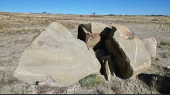
The soil and rock types around Saskatoon are a big reason why farming is so successful there. The area is mainly made up of sedimentary rocks like limestone, shale, and sandstone. Over time, these rocks broke down through weathering and erosion to form rich, fertile soil.
This soil is deep and full of nutrients, which makes it perfect for growing large amounts of crops. It is one of the main reasons settlers chose to live in the area, since farming was so productive. Even today, this fertile soil supports large-scale agriculture and remains one of the most important natural features of the region.

Water
A major water feature in the city is the South Saskatchewan River. This river is very important because it provides fresh water for drinking, farming, and industry. It also helps support local ecosystems by giving habitats to fish, birds, and other wildlife.
The river is also a major recreation area in Saskatoon. People use it for activities like kayaking, canoeing, fishing, walking, cycling, and jogging along the trails. Parks and bridges along the river make it one of the most scenic parts of the city. The river not only supports life but also adds beauty and outdoor space for the community.
Climate
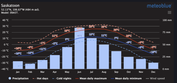
Saskatoon has a continental climate, which means it has very cold winters and warm to hot summers. Winters are long and can be very harsh, with snow, ice, and freezing temperatures lasting for months. People have to dress warmly and adjust their daily routines during this season.
Summers are much warmer but usually short. This is the main growing season for agriculture, so rainfall during this time is very important. Most precipitation falls in the summer, helping crops grow successfully. Spring and fall are shorter transition seasons where the weather changes quickly. Overall, the climate is extreme but very important for farming and the economy.

Population&Ethnicity
Saskatoon has a continental climate, which means it has very cold winters and warm to hot summers. Winters are long and can be very harsh, with snow, ice, and freezing temperatures lasting for months. People have to dress warmly and adjust their daily routines during this season.
Summers are much warmer but usually short. This is the main growing season for agriculture, so rainfall during this time is very important. Most precipitation falls in the summer, helping crops grow successfully. Spring and fall are shorter transition seasons where the weather changes quickly. Overall, the climate is extreme but very important for farming and the economy.

Brief history
People live in Saskatoon because of job opportunities, education, and access to a good quality of life. The city grew because of its fertile land and strong agricultural economy. Early settlers were attracted to farming, especially wheat production, which became the foundation of the economy.
In the early 1900s, Saskatoon expanded quickly with the arrival of railways, schools, and businesses. A major turning point was the creation of the University of Saskatchewan, which helped the city become an important centre for education and research. Over time, Saskatoon also grew into industries like mining, healthcare, and technology. Today, it is a large and growing city that still maintains strong connections to its agricultural roots.

Spots
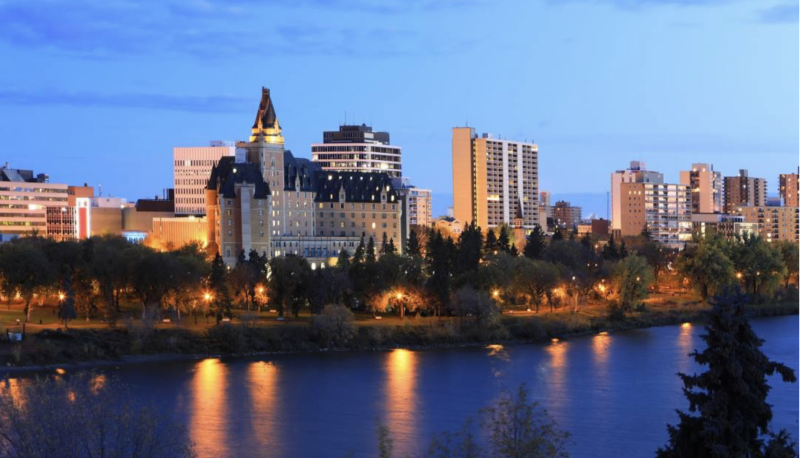
A popular place to visit in Saskatoon is the riverfront along the South Saskatchewan River. It has walking trails, parks, bridges, and beautiful views of the water and city skyline. It is a very popular place for both tourists and local residents.
Another important cultural site is Wanuskewin Heritage Park, which teaches visitors about Indigenous history, culture, and archaeology. It has trails, exhibits, and historical sites that show how people lived in the region for thousands of years.
Downtown Saskatoon is also a popular area with shops, restaurants, and cultural buildings. It shows the modern side of the city while still being connected to its history and natural surroundings.
Why live there?
People live in Saskatoon because it offers a balance of jobs, education, and lifestyle. There are many opportunities in agriculture, healthcare, education, and mining, which makes it a good place to work and build a future. The city also has strong schools and universities, which attract students from many places.
At the same time, Saskatoon is not too crowded and still has access to nature, especially the river and nearby farmland. People can enjoy outdoor activities while still living in a growing city. This mix of opportunity, education, and nature makes Saskatoon a popular place to live.
Saguenay

Resources
Saguenay has several important resources that support its economy. Forestry is one of the main industries because the surrounding region is covered in large, dense forests. Trees are harvested and used for lumber, paper products, and construction materials, which creates many jobs in the area.
Hydroelectric power is another major resource because of the strong rivers in the region. The fast-moving water is used to generate electricity through dams, which provides power for homes, schools, and industries across Quebec. Mining is also important, as the Canadian Shield contains valuable minerals. There is also some agriculture, but it is limited because of the rocky soil and climate conditions.
Overall, natural resources play a huge role in supporting jobs and the economy in Saguenay.

Geography
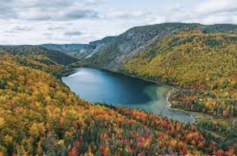
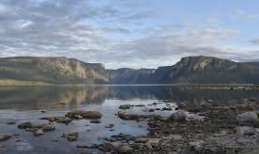
Saguenay is located in Quebec where the Canadian Shield meets the St. Lawrence Lowlands. This creates a unique landscape with forests, hills, rocky terrain, and river valleys. One of the most important landforms in the region is the Saguenay Fjord, a deep valley carved by glaciers and filled with water.
The geography of the area is very scenic, with steep cliffs, wide rivers, and dense forests. The mix of landforms makes the region both beautiful and useful for industries like forestry and hydroelectric power. Most settlements are built in valleys where the land is flatter and easier to develop.

Soil&Rocks
The soil and rock in Saguenay are shaped by its location on the Canadian Shield. The area is mainly made up of igneous and metamorphic rocks that formed millions of years ago under extreme heat and pressure. These rocks often contain minerals that are useful for mining.
The soil in forested areas is thin and rocky, which makes farming difficult. However, in river valleys, the soil is deeper and more fertile because of glacial deposits left behind during the Ice Age. These areas allow for some limited farming, but forestry is still the dominant land use.

Water
The Saguenay River is one of the most important natural features in the region. It flows through deep valleys and connects to the Saguenay Fjord, creating a dramatic water system. The river provides fresh water for communities and supports local ecosystems.
It is also very important for hydroelectric power, which is a major energy source in Quebec. Dams along the river generate electricity for homes and industries. In addition, the river is used for tourism, transportation, and recreation such as boating, fishing, kayaking, and sightseeing.

Climate
Saguenay has a continental climate with very cold winters and warm summers. Winters are long, snowy, and can be very harsh, with temperatures dropping well below freezing. Snow covers the region for several months each year.
Summers are much warmer but shorter, allowing for outdoor activities and some agriculture. The region experiences a wide range of temperatures throughout the year, with strong seasonal changes. Most precipitation falls as snow in winter and rain in summer, which helps support forests and river systems.
Population&Ethnicity
The population of Saguenay is mostly French-Canadian, and French is the main language spoken in the region. The community has strong cultural traditions and a close-knit feel, with many families living there for generations.
There is also some diversity, but the region is strongly influenced by French heritage. Indigenous peoples also have historical connections to the land. Overall, the population reflects a strong cultural identity tied to Quebec’s history.

Brief History
Saguenay was first used by Indigenous peoples for hunting, fishing, and travel along the river. In the 1600s, French explorers arrived, and the region became part of the fur trade network. Later, in the 1800s, logging became the main industry as forests were harvested for timber.
In the 1900s, hydroelectric power and aluminum production helped the region grow into an industrial centre. These industries brought jobs and increased settlement in the area. Today, Saguenay is known for its strong French-Canadian identity and its history based on natural resources and industry.

Spots
A major attraction in the region is the Saguenay Fjord National Park. It is known for its deep waters, steep cliffs, and beautiful natural scenery. Visitors come to hike, boat, and explore the fjord while enjoying views of forests and mountains.
The fjord is one of the most famous natural landmarks in Quebec and attracts tourists from all over. There are also small towns and scenic viewpoints along the river that make the area popular for photography and outdoor activities.
Why live there?
People live in Saguenay because of job opportunities, natural beauty, and a quieter lifestyle. The cost of living is lower than in many larger cities, making it more affordable for families.
The region offers a strong sense of community and is surrounded by forests, rivers, and mountains. People also enjoy outdoor activities like hiking, fishing, and skiing. Overall, Saguenay is a good place for people who want a balance between nature, work, and community life.
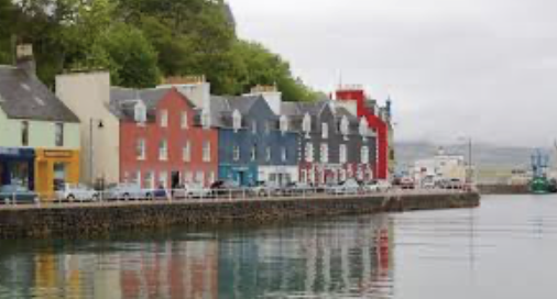
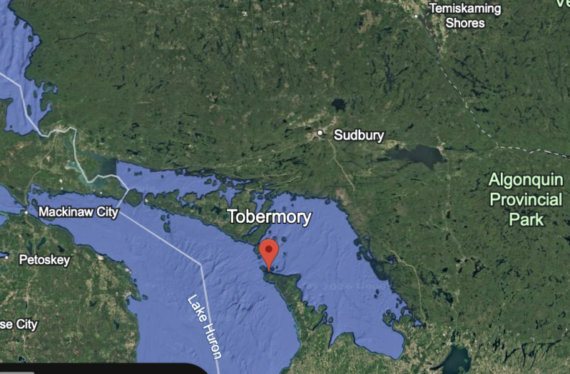
Tobermory
Resources
Tobermory has a small but important economy mainly based on tourism and fishing. Tourism is the biggest resource, especially in the summer when visitors come to explore the natural beauty of the area. Many people work in boat tours, park services, hotels, restaurants, and small local shops that depend on seasonal visitors.
Fishing is also part of the local economy because of the surrounding Great Lakes waters, although it is not as large as tourism. Overall, the community depends heavily on nature-based resources, and many jobs are directly connected to outdoor activities and visitors.
Geography
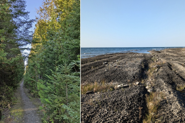
Tobermory is located at the tip of the Bruce Peninsula in Ontario. It sits between two major natural regions: the Great Lakes–St. Lawrence Lowlands and the Canadian Shield. This gives the area a unique landscape that combines rocky terrain with forested land and clear blue water.
The geography includes steep limestone cliffs, dense forests, and shoreline areas along Lake Huron and Georgian Bay. The water is extremely clear because of the limestone bedrock, which makes the area very famous for diving and boating. The mix of land and water creates a very scenic and rugged environment.
Soil & Rock
The soil and rock in Tobermory are mainly made up of limestone bedrock. This type of rock forms part of the Niagara Escarpment and is very hard and solid. Over time, it has created thin soil layers that are not very good for farming.
Because the soil is shallow and rocky, agriculture is limited in the area. However, the limestone helps create unique plant life and supports forest growth in certain areas. The rocky landscape also shapes the cliffs, shoreline, and underwater features that make Tobermory so well known.

Water
Tobermory is surrounded by two major bodies of water: Lake Huron and Georgian Bay. The water here is known for being extremely clear and clean, which is rare in many parts of the Great Lakes.
This water is very important for tourism, especially boating, kayaking, and scuba diving. The area is also famous for shipwreck diving because of the rocky shoreline and past shipping routes. Fishing also takes place in the region, and the water helps support local ecosystems and wildlife.
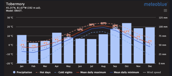
Climate
Tobermory has a moderate climate influenced heavily by the surrounding Great Lakes. Summers are generally cool and comfortable rather than extremely hot, which makes it a popular time for tourists to visit. Winters are cold and snowy, with strong winds coming off the water.
The nearby lakes help regulate temperatures, meaning the area does not experience extreme heat or extreme cold as much as inland regions. However, weather can still change quickly, especially near the shoreline. This climate supports forests and makes the region beautiful year-round, especially during fall and summer.
Population&Ethnicity
The population of Tobermory is small and mostly made up of people who work in tourism and seasonal services. Many residents live there year-round, while others work only during the busy summer months.
The community includes people from different backgrounds, and there is also Indigenous history connected to the area. The population increases significantly in the summer when tourists arrive, which makes the town feel much busier during that season compared to winter.
Brief History
Tobermory was originally used by Indigenous peoples for fishing, travel, and living along the water. In the 1800s, it became an important port town where ships stopped for supplies while travelling through the Great Lakes.
Because of the rocky shoreline and difficult navigation, many shipwrecks occurred in the area, and some of them are still preserved underwater today. Over time, shipping declined and the town shifted toward tourism. Today, Tobermory is best known for its national parks, diving sites, and natural beauty.
Spots
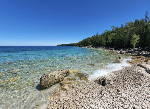
A very popular attraction near Tobermory is Bruce Peninsula National Park. It is famous for its hiking trails, cliffs, and the Grotto, which is a natural rock pool with bright turquoise water. Visitors come from all over to see the clear water, caves, and scenic views.
Why live there
People live in Tobermory because of its peaceful environment and natural beauty. It is a quiet place surrounded by water, forests, and parks, which makes it ideal for people who enjoy nature and outdoor activities.
Tourism provides many job opportunities, especially in the summer months, supporting local businesses and services. Although it is a small community, it offers a relaxed lifestyle away from busy cities. The combination of scenery, nature, and tourism makes it a unique place to live.
Corner Brook
Resources
Corner Brook has several important resources that support its economy. Forestry is one of the main resources because the surrounding area is covered in large forests. These forests provide wood for the pulp and paper industry, which has been a major source of jobs for many years.
Paper production is also very important, with mills processing timber into paper products. Tourism is another growing resource because people visit the area for its mountains, forests, and coastal scenery. Many jobs in the city are connected to these industries, including forestry work, factory jobs, and tourism services.

Geography
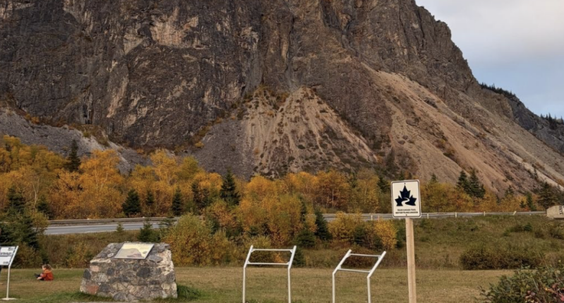
Corner Brook is located in Newfoundland and Labrador in the Appalachian region. The landscape includes mountains, forested hills, river valleys, and coastal areas along the Bay of Islands. This creates a very scenic and varied environment.
The mix of landforms makes the region both beautiful and resource-rich. The forests support forestry, the rivers support hydroelectric power, and the coastline supports fishing and transportation. The geography strongly influences how people live and work in the area.
Soil&Rock
The region around Corner Brook is mainly made up of sedimentary and metamorphic rocks from the Appalachian mountain system. These rocks are very old and formed through pressure and heat over millions of years.
Because of this rocky base, the soil is often thin, acidic, and not very fertile. This makes farming difficult in most areas. However, the soil is still important because it supports large forests, which are one of the most valuable natural resources in the region.

Water
Corner Brook is located near the Bay of Islands and has many rivers and streams flowing through the region. These waterways are an important part of the environment and economy.
The rivers are used for hydroelectric power, which provides electricity for homes and industries. They also support fishing, wildlife, and recreation such as boating and kayaking. The water system helps connect the forests, mountains, and coastline, making it an important part of the region’s geography.

Climate
Corner Brook has a maritime climate influenced by the Atlantic Ocean. This means temperatures are generally moderate compared to inland areas. Summers are cool and mild, while winters are cold but not extremely harsh.
The region receives precipitation throughout the year, including rain and snow. Snowfall is common in winter, and the ocean helps keep temperatures from becoming too extreme. This climate supports the growth of dense forests and keeps the landscape green and moist.
Population and Ethnicity
The population of Corner Brook is mostly of European descent, with strong cultural traditions linked to early settlers in Newfoundland. There are also nearby Indigenous communities, including Mi’kmaq peoples, who have long histories in the region.
The city has a close-knit and friendly community. It is smaller than major urban centres, and many people know each other. Residents often work in forestry, industry, healthcare, and tourism, which are the main sources of employment.
Brief history
Corner Brook was originally inhabited by Indigenous peoples, including the Mi’kmaq, who used the land for hunting and fishing. In the early 1900s, the area developed rapidly because of its large forests and access to rivers.
A major pulp and paper mill was built, which created many jobs and caused the population to grow quickly. This made Corner Brook an important industrial centre in Newfoundland and Labrador. Over time, the economy expanded, and tourism became more important alongside forestry and paper production.
Spots
A popular attraction near Corner Brook is Gros Morne National Park. It is known for its dramatic landscapes, including mountains, fjords, and hiking trails. Many visitors come each year to explore its natural beauty.
The park is one of the most famous natural attractions in Canada and is great for hiking, sightseeing, and photography. It shows the unique geology and scenery of Newfoundland and Labrador.
Why live there?
People live in Corner Brook because of job opportunities, natural beauty, and a peaceful lifestyle. The forestry and paper industries provide steady employment, while tourism also supports the economy.
The city is quiet and close-knit compared to larger urban centres, which makes it appealing for people who prefer a slower pace of life. Residents also enjoy easy access to nature, including forests, rivers, mountains, and the coastline.
Create Your Own Website With Webador